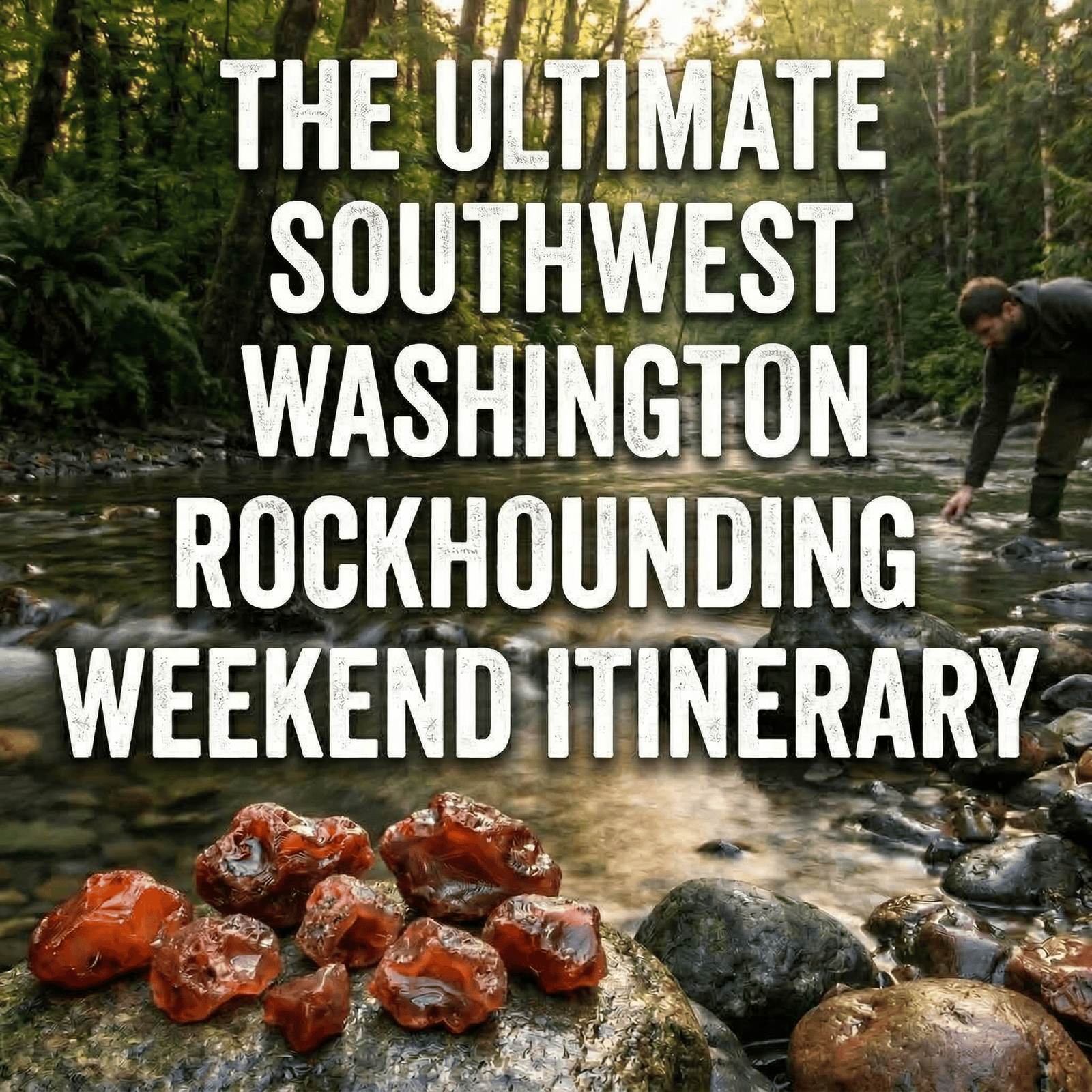
Picture this: you’re knee-deep in a Southwest Washington river, sun on your back, and the gravel under your boots is full of glowing red treasures. The rivers here carry carnelian agates born from ancient volcanoes, and with the right plan, one weekend can turn into a trip you’ll remember for years. This isn’t just a list of spots; it’s a turn-by-turn, carefully planned weekend guide built to maximize your finds and cut down on guesswork and stress.
At a glance: Two-day itinerary in Lewis County, Washington. Day 1: Stan Hedwall Park (Newaukum River), Hash (lunch), Lewis and Clark State Park (camp). Day 2: Lucas Creek (verify access), Schaefer County Park (Skookumchuck), Country Cousin (dinner). Discover Pass required for state parks. Stan Hedwall is seasonal; confirm before you go.
Why Southwest Washington? The region sits in the heart of what collectors call the Lewis County Agate Belt: a band of Eocene basalt and silica-rich geology where some of the state’s richest, deepest red carnelians show up in river gravels. The same volcanic story that formed Washington’s agates is written all over these creeks: Salmon Creek, the Newaukum, Lucas Creek, and the Skookumchuck. This guide ties those names into a real weekend you can actually run.
Crucial Preparation and Legal Disclaimers (Read This First!)
Stay Safe, Stay Legal
Important: The information in this article is for general interest and trip-planning only. It is based on publicly available information and commonly cited access points. It is your responsibility to verify private property boundaries, state and federal land-use rules (including Washington Department of Natural Resources and U.S. Forest Service regulations), and any required permits (such as a Washington Discover Pass or day-use permits) before you go. Access, ownership, and regulations change. We do not guarantee that any location mentioned here is currently legal to collect at, open to the public, or safe. Conditions, road access, and park rules can change without notice.
Private property: Trespassing is illegal and hurts the reputation of rockhounding for everyone. Always respect “No Trespassing” signs, gates, and purple paint markings (in Washington, purple paint on trees or posts means no trespassing). When in doubt, assume land is private until you confirm otherwise with the landowner or an official source.
Liability: Agate Outpost and the author assume no liability for your actions, safety, travel, or collecting decisions. You rockhound at your own risk. Check weather, water levels, and local conditions; tell someone your plans; and follow all applicable laws and land-manager rules.
Before you set foot on any gravel bar, lock in the basics: know whose land you’re on, what’s allowed there, and what permits you need. A few minutes of checking can keep you legal and keep access open for others. When in doubt, call the local DNR or forest office, or the county, and ask.
Recognize private property signage: In Washington, “No Trespassing” signs, locked gates, and purple paint on trees or posts all mean stay out. Purple paint is legally equivalent to a no-trespassing sign in many states, including Washington. If you see it, do not enter. Respecting boundaries protects the hobby for everyone.
What to Pack (Essentials vs. Pro)
Your comfort and safety directly affect how long you can hunt and how much you enjoy it. Use our 5 Must-Have Tools for Every Agate Hunter and Rockhound Gear & Gem Gift Guide for full lists; here’s the short version for a weekend:
- Footwear: Sturdy, closed-toe shoes or wading boots with good grip. River rocks are slippery; sandals are a no-go for serious hunting.
- Safety: Safety glasses (flying chips when you crack or inspect rocks), work gloves, and a first-aid kit. Sunscreen and a hat. You’ll be in the open a lot.
- Hydration & fuel: More water than you think you need, plus snacks. Summer sun on gravel bars is draining.
- Collection: Bucket or bag, small pick or rock hammer if you’re allowed to use one where you’re at, and a loupe or magnifier. A headlamp is handy for early starts or late finishes.
Pro tip: keep a change of clothes and a towel in the car. You will get wet or muddy; dry clothes for the drive home make the trip much better.
- Discover Pass: Washington state parks and many DNR/WDFW sites require a Discover Pass for day use and parking. As of 2025, a one-day pass is about $10 and an annual pass about $30–45; buy online at discoverpass.wa.gov or by phone at 866-320-9933. Confirm current pricing and whether your chosen site requires it.
- Season: Late summer and early fall usually offer the lowest water and the most exposed gravel; spring runoff can make access dangerous or impossible. Some county parks (e.g., Stan Hedwall) close seasonally for flooding risk. Check before you go.
Day 1: Exploring the Northern Reach (Salmon Creek / Newaukum Area)
Day 1 focuses on the northern part of the Lewis County Agate Belt: Salmon Creek and the Newaukum area. You’ll start easy and ramp up as the day goes on.
Morning (The "Warm-Up" Spot)
Location: Stan Hedwall Park (1501 Rice Road, Chehalis) is a frequently cited public access point with frontage on the Newaukum River and gravel bars that are popular with rockhounds. The park is Chehalis’s largest at 204 acres, with about 100 acres of forest and trails. It is closed seasonally (typically late November through early March) due to flood risk. Confirm opening dates and current rules before you go. Call (360) 748-0271 or check the City of Chehalis parks department for hours and whether rock collecting is permitted. If you prefer the Salmon Creek area near Toledo (where Salmon Creek meets the Cowlitz), verify current public access and any collection rules; the Pacific Highway bridge area is sometimes cited historically, but access can change.
Why it’s great for beginners: The terrain at Stan Hedwall tends to be relatively gentle: established paths and short walks to the river, and gravel bars you can wade along without deep or fast water. It’s a good place to tune your eyes to the local gravel and get used to scanning for that telltale red glow.
Pro tip: Park in the main lot and focus on gravel bars that are exposed after summer low water or after a recent high-water event. The best bars are often just downstream of a bend or near a known landmark. Do your homework with a map and, if possible, a quick scout the evening before. Morning light from the side can make translucent carnelian stand out against gray gravel. Wet stones often show color better than dry ones: a quick splash or scanning right at the water’s edge can reveal pieces that look dull on dry land.
Lunch suggestion: Hash (1232 Alder St, Centralia) is a local favorite with scratch-made breakfast served all day: hearty portions, crispy potatoes, omelets, and pancakes. It’s a solid refuel stop between morning and afternoon hunting. Confirm hours before you go.
Quick morning checklist: Sunscreen on, water in the pack, boots laced, and a clear idea of where you’re allowed to be. If the park or access has a kiosk or map, give it a quick read for any seasonal rules or closed areas.
Afternoon (Advanced Prospecting)
Location: Shift to another public access point in the same general area that’s known for slightly harder terrain or less-picked gravel. Again, verify access and rules before you go.
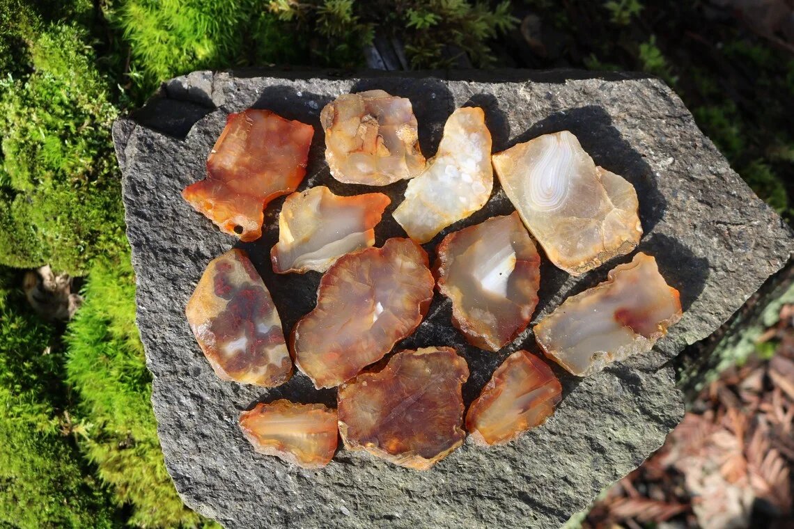
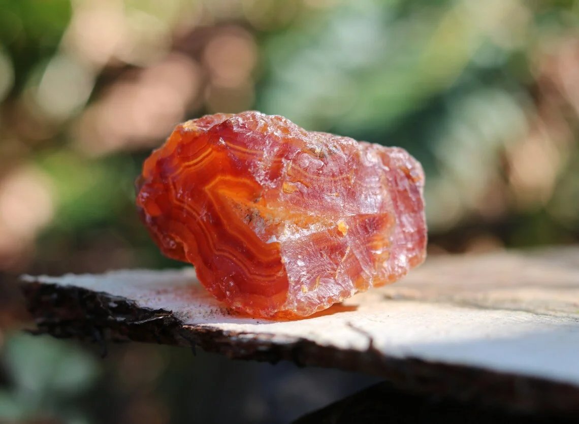
What to look for: In this stretch, carnelians often show a mix of banding and translucency. Some pieces have a thin, dull “rind” that hides the color until they’re wetted or tumbled; others show a deep red or orange even when dry. Look for the key traits of carnelian agate: waxy luster, conchoidal fracture, and that characteristic glow in backlight.
Technique tip: A small UV flashlight can help you spot certain inclusions or subtle banding in chalcedony. Not every stone will react, but it’s a useful field trick once you’re comfortable with the basics. Combine that with “sun from behind” (holding a suspect rock up to the light to check translucency) to decide what’s worth taking home. For more on what to look for in the field, see our carnelian agate identification guide.
Afternoon safety note: River levels can change. Stay off bars that are being undercut by current, and never wade in fast or deep water. If you’re with others, keep visual contact and agree on a meet-up time and place.
Evening (Dinner & Camping)
Local diner: The Centerville Cafe (111 N Tower Ave, Centralia) is a beloved local spot for comfort food: chicken fried steak, burgers, meatloaf, and homemade pies. It’s a good place to decompress after a long day on the river. Confirm current hours before you go.
Camping / accommodation: Lewis and Clark State Park (4583 Jackson Highway, Winlock, WA 98596) is about 12 miles south of Chehalis and offers camping in old-growth forest. A Discover Pass is required for entry; camping fees and site types (tent and RV) vary. Reservations are recommended: book at washington.goingtocamp.com or call (360) 864-2643. Check seasonal availability and water/hookups before you book. An alternative is Ike Kinswa State Park (873 State Route 122, Silver Creek), about 37 minutes east of Centralia on Mayfield Lake, with 95 campsites and cabins; reservations at the same state parks system. Both parks are rockhound-friendly in the sense that they put you close to Day 1 and Day 2 river access; always follow park rules and leave no trace.
End Day 1 with your gear organized for the next morning: refill water, charge headlamps, and set your alarm so you can hit Day 2’s spot early when the light is best.
Day 2: The Heart of the Lewis County Belt (Lucas Creek / Skookumchuck)
Day 2 moves you into the core of the Lewis County Agate Belt: Lucas Creek and the Skookumchuck. These waters have a reputation for strong carnelian and for mixed ownership, so again, verify every access point.
Morning (A New River, A New Hunt)
Location: Public access along Lucas Creek, and only where you have confirmed public access or permission. Much of Lucas Creek flows through private timber and farmland; never assume you can enter without explicit permission or a verified public access point.
Parking: Use only designated pullouts or parking areas that you’ve confirmed as legal. Never block gates or private driveways. For public Skookumchuck access later in the day, see the afternoon section below.
Hunting tip: Many people instinctively head upstream. Walking downstream first can put you on less-picked gravel and give you a different mix of material. Combine that with hitting the bars early, before the sun bakes everything and glare makes spotting harder. Lucas Creek has a reputation for high-quality carnelian; even small, well-formed pieces are worth keeping for tumbling or display.
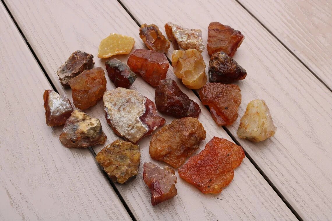
What to look for here: Deeper reds and strong translucency are common in this belt. Stones with a thick, opaque rind often hide the best color inside. If the shape and weight feel right, take it home and let the tumbler reveal it. For more context on why this area produces such rich color, see our Lewis County Agate Belt and why iron oxide turns agates red.
Afternoon (Maximizing the Shine)
Location: Schaefer County Park (822 WA-507, Centralia) is a 14-acre Lewis County park on the Skookumchuck River with year-round public access. It offers picnicking, trails, and river frontage. It's a good option for an afternoon on the Skookumchuck looking for agates and jasper. Confirm current park rules and whether rock collecting is allowed; call Lewis County Parks at (360) 740-1495 or check lewiscountywa.gov. The confluence of two creeks or a section where the river has undercut the bank often concentrates heavier stones; plan your walk within the park’s legal boundaries.
Specific stretch: Walk the river within the park’s designated access area. Always respect boundaries and stay on land you’re allowed to be on; do not venture onto private property downstream or upstream.
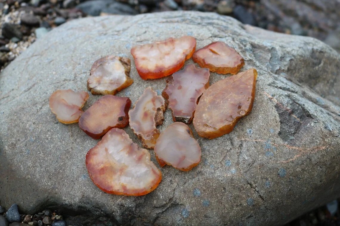
Pro tip (field to workshop): The biggest, crustiest-looking rocks you find today might be the ones that polish up best. Don’t dismiss a lumpy, dull exterior. It often hides solid carnelian inside. Those are prime candidates for your first-stage tumbling load: coarse grit will reveal what’s under the rind. Sort your haul at home: keep the best translucents for polishing and use the rest for practice or display as rough.
Skookumchuck note: The Skookumchuck is known for agates and jasper. Schaefer County Park (above) is one verified public access point; the same principles apply there: low water, morning or afternoon light, and less-picked bars. Areas near the dam or on private land are off-limits without permission.
Evening (The Wrap Up)
Plan a simple “farewell” dinner at a spot you didn’t try on Day 1. Country Cousin (1054 Harrison Ave, Centralia) serves breakfast, lunch, and dinner in a homey atmosphere (open until 10–11 p.m. depending on the day). McFiler’s (543 NW Pacific Ave, Chehalis) is a classic American diner open until 2 a.m. with karaoke and trivia some nights. Confirm current hours and availability. It’s a good way to close the loop on the weekend and debrief: what worked, what you’d do differently, and where you’d like to return.
Summary and Reader Bonus: The Ultimate Itinerary Map
A planned trip really does maximize discovery. You spend less time figuring out where to go and more time with your eyes on the gravel. We’ve outlined a two-day flow: Day 1 in the Salmon Creek / Newaukum area, Day 2 on the Lucas Creek / Skookumchuck side. Adjust it to your starting point, season, and the latest access info.
Save this itinerary to your phone: Open the link below in Google Maps to see the full weekend route (all stops in order). You can send the link to your phone, start directions, or save individual stops to a list.
Open full itinerary in Google Maps
Route order: Stan Hedwall Park (Day 1 morning) → Hash (lunch) → Lewis and Clark State Park (camp) → Schaefer County Park (Day 2 afternoon) → Country Cousin (dinner). For dinner you can swap in McFiler’s, 543 NW Pacific Ave, Chehalis. Search it in Maps and add as a stop if you prefer.
- Day 1 morning Stan Hedwall Park 1501 Rice Rd, Chehalis, WA
- Day 1 lunch Hash 1232 Alder St, Centralia, WA
- Day 1 camp Lewis and Clark State Park 4583 Jackson Hwy, Winlock, WA
- Day 2 afternoon Schaefer County Park 822 WA-507, Centralia, WA
- Day 2 dinner Country Cousin 1054 Harrison Ave, Centralia, WA
- Day 2 dinner (alt) McFiler's 543 NW Pacific Ave, Chehalis, WA
Post-Trip Value (What’s Next for Your Finds?)
Once you’re home, the fun continues. Give your finds a gentle clean and inspect them in good light. Our guide on how to clean and care for your carnelian agates will help you do it safely. When you’re ready to compare your stones to what’s sold as “natural” vs. heat-treated, use our guide to identifying natural vs. heat-treated carnelian so you know exactly what you’ve got. From there, tumbling, cutting, or displaying your Southwest Washington carnelians will keep you connected to this weekend for a long time.
We hope this itinerary gives you a clear, responsible framework for a Southwest Washington rockhounding weekend. Verify access, stay legal, pack right, and enjoy the hunt.
For more Washington-wide ideas, see our Best Places to Find Carnelian Agates in Washington State. That guide is also for general interest; always confirm access and regulations yourself before visiting any location.
Frequently asked questions
- Do I need a Discover Pass for rockhounding in Washington state parks?
- Yes. Washington state parks and many DNR/WDFW sites require a Discover Pass for day use and parking. Buy online at discoverpass.wa.gov or call 866-320-9933. One-day and annual passes are available.
- Where can I find carnelian agates in Southwest Washington?
- The Lewis County Agate Belt includes the Newaukum River (e.g. Stan Hedwall Park, Chehalis), Salmon Creek near Toledo, Lucas Creek (verify public access; much is private), and the Skookumchuck River (e.g. Schaefer County Park, Centralia). Always confirm current access and collecting rules.
- Is Stan Hedwall Park open year-round for rock collecting?
- No. Stan Hedwall Park is typically closed late November through early March due to flood risk. Call (360) 748-0271 or check the City of Chehalis parks department for current hours and whether rock collecting is allowed.
- What is the best time of year for river rockhounding in Lewis County?
- Late summer and early fall usually offer the lowest water and the most exposed gravel bars. Spring runoff can make access dangerous or impossible. Some county parks close seasonally.
Recap: your weekend in a nutshell
- Day 1: Stan Hedwall Park (Newaukum) or Salmon Creek area in the morning, another public bar in the afternoon, lunch at Hash (Centralia), dinner at Centerville Cafe, camp at Lewis and Clark or Ike Kinswa State Park.
- Day 2: Lucas Creek (where you have verified access) in the morning, Schaefer County Park (Skookumchuck) in the afternoon, farewell dinner at Country Cousin or McFiler’s.
- Before and after: Discover Pass and any permits, pack essentials and safety gear, then clean and care for your finds and consider tumbling your best rough.